
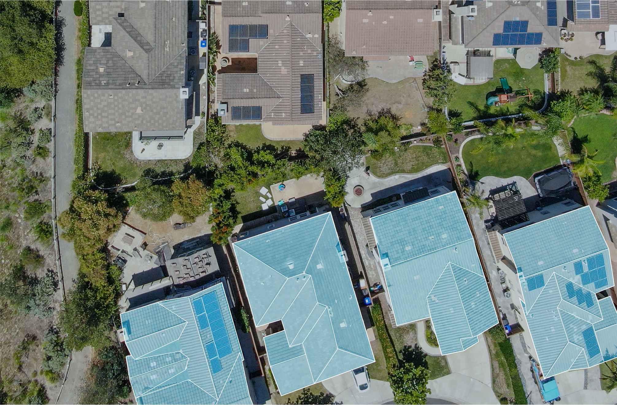
A 200,000-square-foot roof is not something you inspect on foot
Try to honestly evaluate a distribution-center roof along the Council Road industrial corridor by walking it, and the inspection works against itself. By the time a crew grinds across that much membrane, ponding has evaporated, the shallow low spots have blurred together, and the inspector has dragged grit over half the seams. So we fly them. A drone carrying a high-resolution optical camera and a radiometric thermal sensor maps every drain sump, seam, curb, and penetration on a big-box roof off the Memorial Road retail strip or a warehouse near the airport in one programmed flight, and it does all of that without loading a membrane whose condition we have not yet confirmed.
The reason we fly thermal, not just a camera
An optical photo shows you a surface. It cannot show you the water hiding beneath it, and on large low-slope roofs that hidden water is the whole problem. When moisture saturates the insulation under the membrane, that wet board soaks up the day's heat and holds it. As the roof cools after sunset, the saturated zones stay warmer than the dry material around them and bloom on the infrared image as sharp-edged shapes, frequently a long way from the spot where a ceiling tile is staining inside. On a roof the size of a manufacturing plant, that is the gap between guessing where the wet insulation sits and knowing its exact outline before a scope is ever written.
The flight is timed to physics, not the calendar
A thermal survey only tells the truth under the right conditions. We need a dry roof, a day with enough sun to charge the assembly with heat, and the cooling window after sunset when the contrast between wet and dry peaks. Flown at midday, or right after a rain, the same sensor produces a clean-looking image that means nothing. Oklahoma City's intense summer sun loads a roof beautifully for thermal work, but that same heat feeds the late-day storm pattern that fires across the metro through the warm months, so we watch the radar and the dew point as carefully as we watch the battery state of charge. A survey planned around the weather is the only kind worth flying.
Cores turn a thermal flag into a fact
Infrared points us where to cut; it does not, by itself, prove what is underneath. Every anomaly a flight identifies gets verified with a physical core, a small plug taken down through the assembly so we can see and feel the insulation, confirm it is genuinely saturated, and check the deck below. We mark each flagged area on the roof map, pull cores at representative points, and only then label a zone wet. That two-step discipline is what makes a moisture map defensible when an owner is weighing a contained repair against a full tear-off and wants the decision built on evidence rather than a thermal picture alone.
Flying commercial means flying by the rules
Commercial drone work is regulated, and we run it that way. Flights operate under the FAA's Part 107 rules for small commercial unmanned aircraft, with close attention to the airspace around Will Rogers World Airport and Wiley Post Airport, controlled airspace where authorization through the LAANC system has to be in hand before the aircraft leaves the ground. We check the airspace classification for every address, secure whatever authorization the location requires, hold visual line of sight throughout, and keep the aircraft clear of people and neighboring operations. Over an occupied retail center or an active plant, that also means scheduling the flight window so we are not hovering above a full parking lot at the busiest hour. Operating by the book is also what keeps the inspection insurable and the imagery admissible in a claim.
Imagery built to satisfy an adjuster
After a hailstorm, and the Oklahoma City metro absorbs more than its share, the real value of an aerial inspection is the record it leaves behind. We deliver GPS-tagged imagery that maps hail-impact density, wind-displaced or lifted membrane, and damaged rooftop units, packaged the way commercial property adjusters expect to receive a file. Because every frame is geolocated, an adjuster reviewing the claim from a desk can tie each photo to a precise point on the roof, which strips out the back-and-forth and moves the claim along. For post-storm documentation we move quickly: the imagery is the evidence while the damage is still fresh, so an emergency flight typically turns around within a day or two of the event.
The same flight sharpens a re-roof bid
The survey that documents a claim also makes for a far cleaner replacement estimate. Aerial imagery yields accurate roof-area measurements, pinpoints every penetration and curb, and records the existing conditions, so whoever specs the new roof is drawing from what is actually up there. That trims the surprise change orders and RFIs that pile up when a scope gets written from a rushed walk-through and a sketch on a clipboard.
Questions Oklahoma City owners ask about drone roof inspection
Why is a drone better than sending someone to walk the roof?
It covers the whole surface systematically at a steady altitude, produces a complete optical and thermal record, and never adds foot traffic that abrades a membrane and creates liability on a roof of unknown condition. On large low-slope roofs a walk-through eats hours and still misses the low areas where water collects, and thermal moisture mapping at that scale is simply impossible on foot.
Can infrared really locate moisture trapped under the membrane?
Yes, when the flight is timed correctly. Wet insulation holds the day's heat longer than dry insulation, so during the post-sunset cool-down the saturated zones read warmer on the thermal image. We confirm every flagged area with a physical core before calling it wet, which is what makes the moisture map solid enough to anchor a repair-versus-replace decision.
Are you cleared to fly near Will Rogers airport?
We operate under FAA Part 107 and check the airspace for every site. Around Will Rogers World Airport and Wiley Post Airport the airspace is controlled, so we obtain LAANC authorization before the flight, hold visual line of sight, and stay clear of people and active operations.
How big does a roof need to be to justify a flight?
The larger and flatter, the bigger the payoff. Distribution centers, manufacturing plants, retail centers, and multi-building campuses are ideal candidates. For any commercial roof past roughly 10,000 square feet that needs a real condition assessment, the aerial-plus-thermal approach is both faster and more thorough than walking it.
How fast can you get up after a storm?
Emergency post-storm flights for claim documentation are prioritized, weather permitting, and usually go up within a day or two so the damage is captured while it is fresh. Routine condition surveys are typically scheduled within several business days, timed to the dry, post-sunset window the thermal scan depends on.
Start with a roof walk.
Send the building address, roof concern, and timing. We will help define the next step.
Contact Us